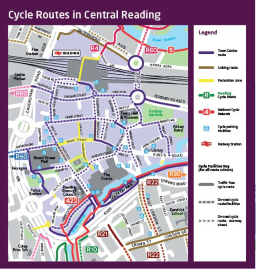
If you take a look at the RBC Cycle Routes map, you’ll see a number of brown ‘linking routes’ are shown.
One of our members raised this with us via our Facebook page.
We’ve now had a response from RBC to clarify:
The linking route
-
is a cycle route and can always be used by cyclists
-
could be on road (if appears as a broken line in the map) then used also by vehicles or as an off-road route (if appears as a full line) used also by pedestrians
-
it is not one of Reading’s branded cycle routes (R1, R10, R2, R20 – etc)
-
The linking cycle route – provides the link between important cycle routes in Reading. The linking route links between:
-
branded cycle routes in Reading (e.g. links R40 and R5)
-
branded cycle routes and the National Cycling Network (NCN)
-
branded cycle routes/NCN network and further destinations – outside Reading Council boundary.
-
You can download the full map here
Susan Children
RCC Publicity Coordinator