The Draft Reading Transport Strategy 2036 is out for consultation, see https://consult.reading.gov.uk.
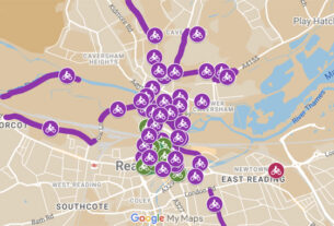
The consultation on the Reading Transport Strategy includes the Local Cycling and Walking Infrastructure Plan and the details of what is proposed in terms of cycling routes are provided within the appendices. Appendix C gives an overall cycling network plan and Appendix G gives a prioritised list of measures.
The area covered includes part of West Berks and Wokingham District too. There are a number of welcome suggestions, both routes on the plans and the measures proposed. What is included and missing from these proposals is important and likely to affect funding of future cycle routes.
The following are RCC’s early thoughts:
The map of proposed routes appears to be a useful start, but there are a number of areas that need revising. Also, there are gaps in the proposed infrastructure provision. Both points are partially covered below.
The Town Centre
The town centre area is still missing key strategic through routes, which RCC requested, and it is unclear what form any of the marked routes could take.
The orbital route via the IDR to the west is interesting or awful depending on what is proposed! I’d suggest that a north-south route via the Butts and West Street may be preferable, as well as a north-south route via the Market Place.
A route from the Market Place through Abbey Gateway to Kings Road should be added, and also the existing Queen’s Walk to Hosier Street link.
Caversham
Looking at the Caversham area I see the Strategic Routes as possibly acceptable, although I’d prefer to add Henley Road to Caversham Centre. If this came via Lower Henley Road and South View Avenue, it could link via St John’s Road and Mill Road to the Thames path.
The key Gosbrook Road link needs to be added from Prospect Street to Westfield Road. The alternative footpath to South Street is less than 1.5m wide!
The current advisory cycle route via St Peter’s Avenue has been deleted; we request that this be reinstated as it is quiet and has more reasonable gradients than other routes. Balmore Walk NCN route should be re-classified from local to leisure.
With all the routes they will depend on the quality of the infrastructure that is ‘possible’ to achieve, both physically and politically!
Tilehurst and West Reading
Routes in West Berkshire (Theale, Calcot, Purley and Pangbourne) are included, but these seem few in number and unlikely to satisfy many cyclists.
Is Kentwood Road suitable as an orbital route? Maybe Oak Tree Road is preferable as it is not excessively steep.
South Reading
The Elgar Road route is only included as a local route, with the proposed strategic route being via Whitley Street. Isn’t Elgar Road a preferable route to south Reading? Christchurch Road is well used by cyclists and should be included as a local route.
General Cycle Comments
Regarding the infrastructure proposed there appears to be nothing on lower speed limits, which are crucial. 20mph limits should be widespread, not just on cycle routes, but also some 10 or 15mph limit areas could be proposed near schools or shopping areas?
Nor is there anything regarding road closures (except cycling) to try to restrict through motor traffic but encourage cycling and walking.
Raised tables and reduced radii corners at side-roads should be part of the design philosophy to slow traffic at corners and to assist pedestrians to cross.
I suggest that electric bikes are included as part of the strategy, as a key way to entice drivers out of their cars and passengers from buses! Electric scooters and similar ‘tech’ products could also be popular forms of transport in future and the network developed to accommodate them.
Other Comments
Workplace parking charges should be considered, with charges going into cycling and walking schemes. A low charge with funding prioritised to supporting sustainable transport at the workplace.
The Third Thames bridge, if built, should have a toll to reduce/control use, and discourage non-local use by variable tolls. Toll revenue should support sustainable transport if not required for the capital cost of the bridge. Without traffic restraint, possible by tolling, the bridge would not receive approval by South Oxfordshire.
Park and ride should not be a priority as it can encourage more car use to the parking sites. Better to support longer strategic bus routes, such as the good X services, and include cycle (and car) parking at out of town villages and other suitable locations such as Woodcote and Cane End.
Your Suggestions
Please let the Campaign (as well as the Council) know your views so that we can amend our final response.
John Lee
RBC Campaigner for RCC